Software for Rapid Detour Management
One of the tools we develop as part of ITS projects is back-office software for automatically preparing specialised GPS navigation for bus and tram drivers, displayed on onboard computer screens. This type of solution is increasingly becoming standard in larger cities, helping newly employed drivers follow the correct route for a given service.
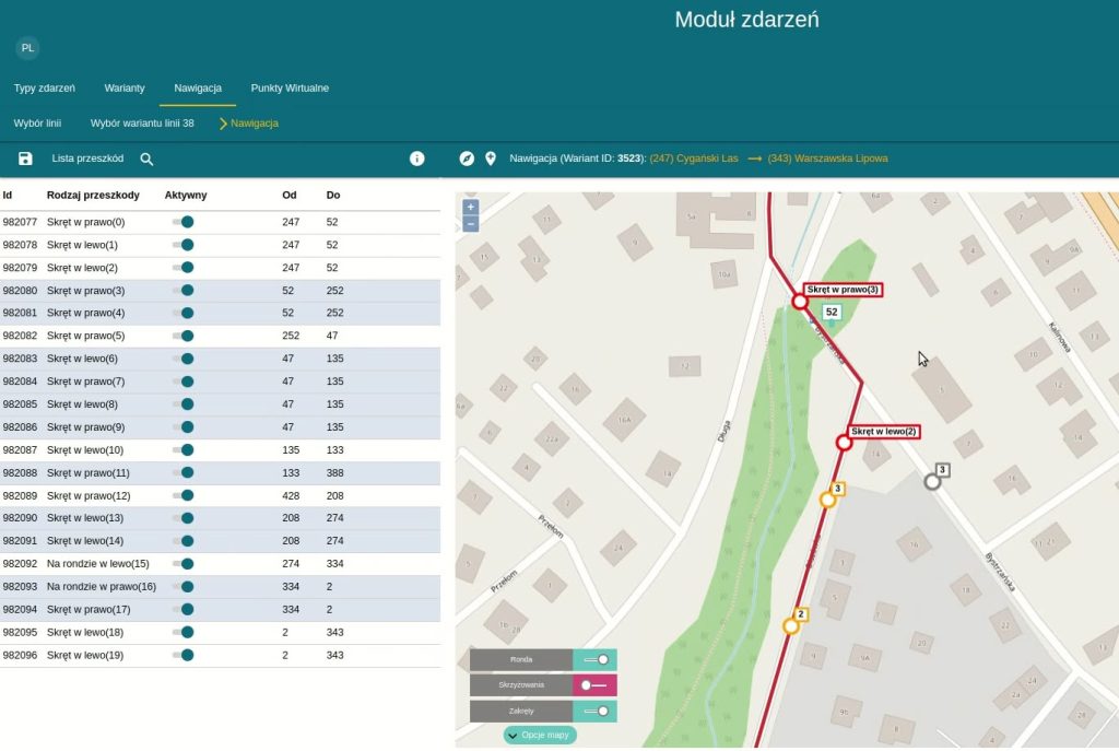
Using the free OpenStreetMap (OSM) map base, the system makes it possible to detect and assign turn points to any location along a route, precisely define reporting points together with relationships and weighting parameters for intersection priority purposes, and specify areas whose detection can trigger actions such as displaying location-specific advertisements or announcements on LCD screens inside the vehicle.
An example system screen showing a selected route variant and the list of navigation points created for it is attached to this post.
The GPS data generator we developed is currently used by PIXEL in the graphical user interface (GUI) of PTD-10 terminals (XC-6 onboard computers) installed in MZK Bydgoszcz vehicles.
At the link below, you can watch a video from the “szymi_trans busdriver” YouTube channel demonstrating the navigation system in real-world operation: