


Offer
Central Passenger Information and Fleet Management System – CeSIP
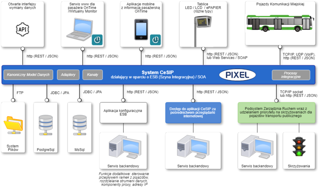
CeSIP Core is a comprehensive module of the Dynamic Passenger Information and Fleet Management System, developed by us exclusively for our business partner, PIXEL sp. z o.o.
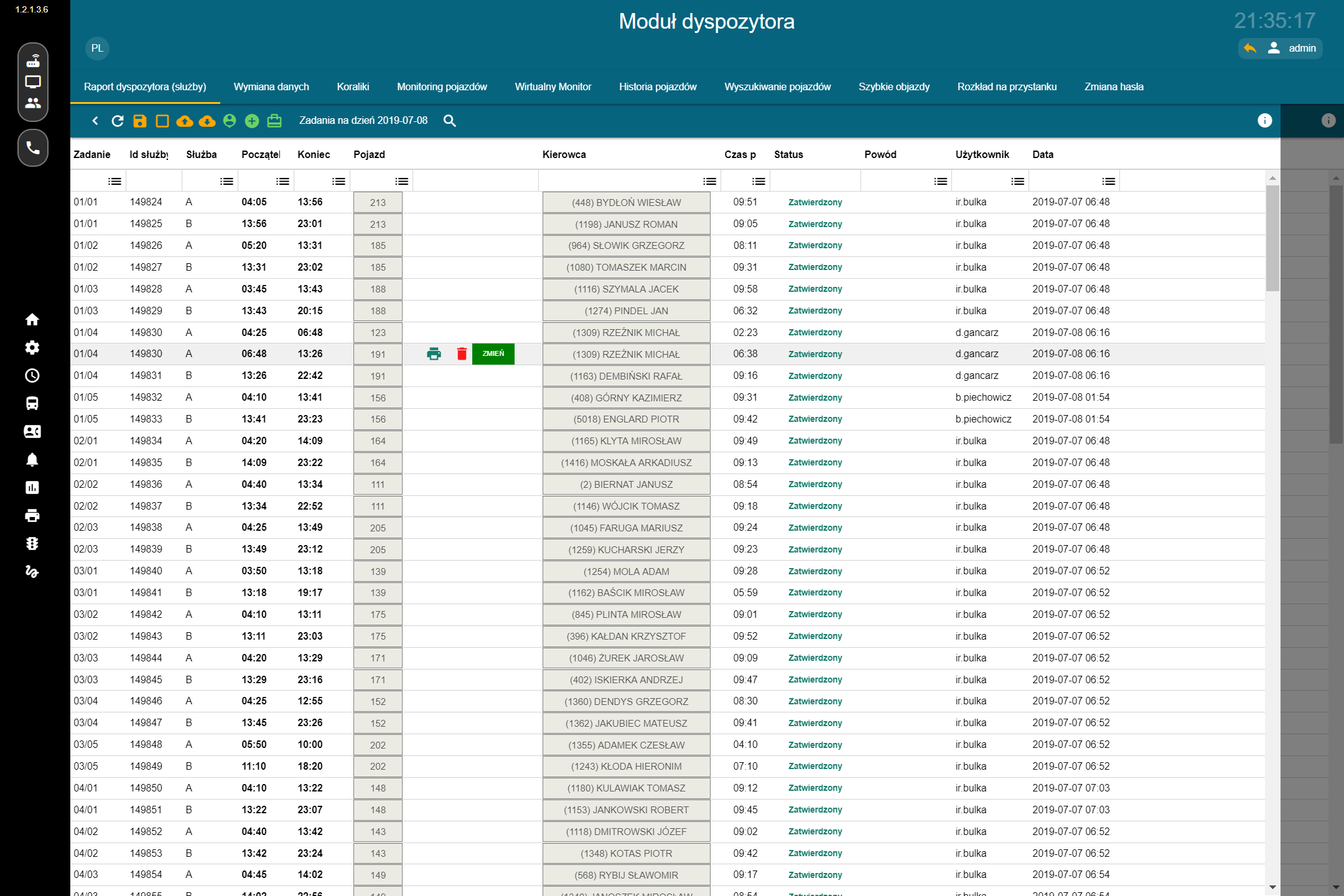
The solution is designed for the ongoing supervision of public transport operations. It brings together data from vehicles, timetables provided by various systems and in different formats, stop infrastructure, and external systems within a single environment. This enables dispatchers to monitor the fleet, respond to disruptions, and manage the information delivered to passengers.
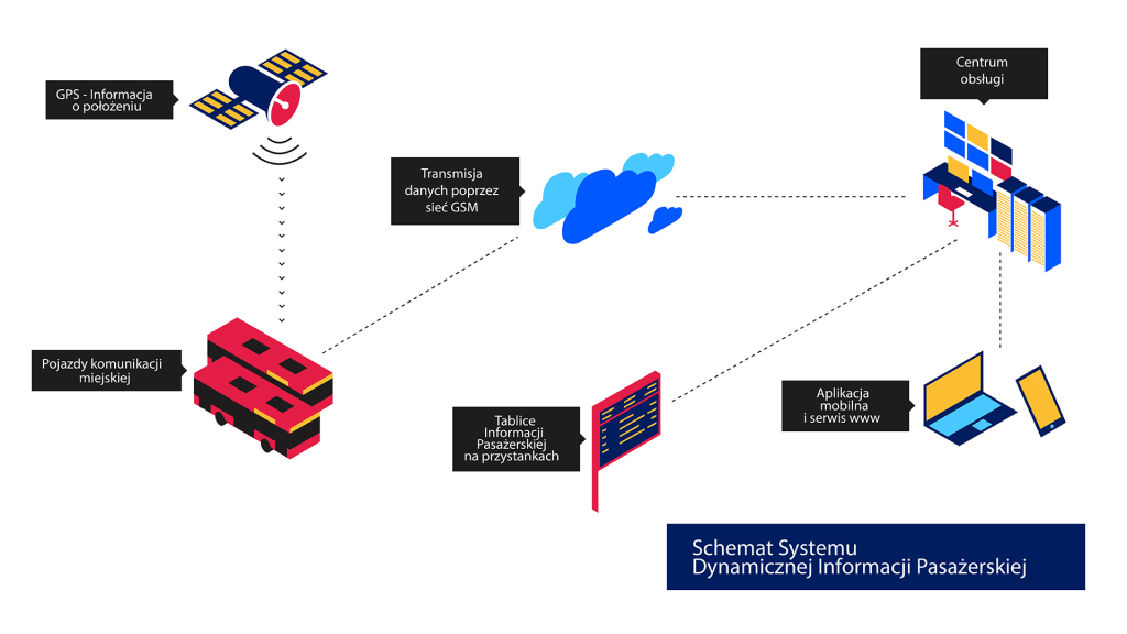
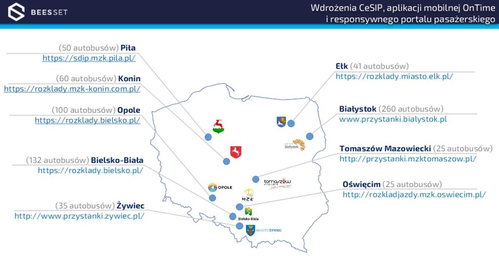
CeSIP integrates with, among others, public transport vehicles, passenger information displays, mobile applications, web portals, traffic management systems, and traffic signal control systems. It serves as a central repository for timetable data as well as actual and predicted service operation times.
The system architecture supports integration with external solutions, including timetable data systems and duty scheduling platforms. Data exchange can be carried out using various mechanisms and interfaces, including REST API/JSON, SQL database access, and GTFS and TransXChange (TXC) files.
Line Diagrams (“Bead” View)
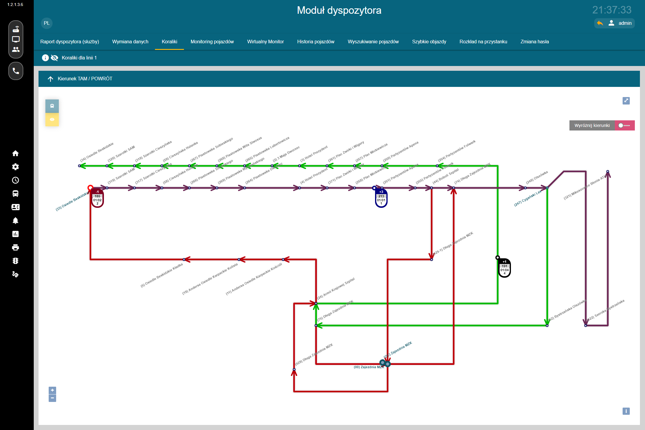
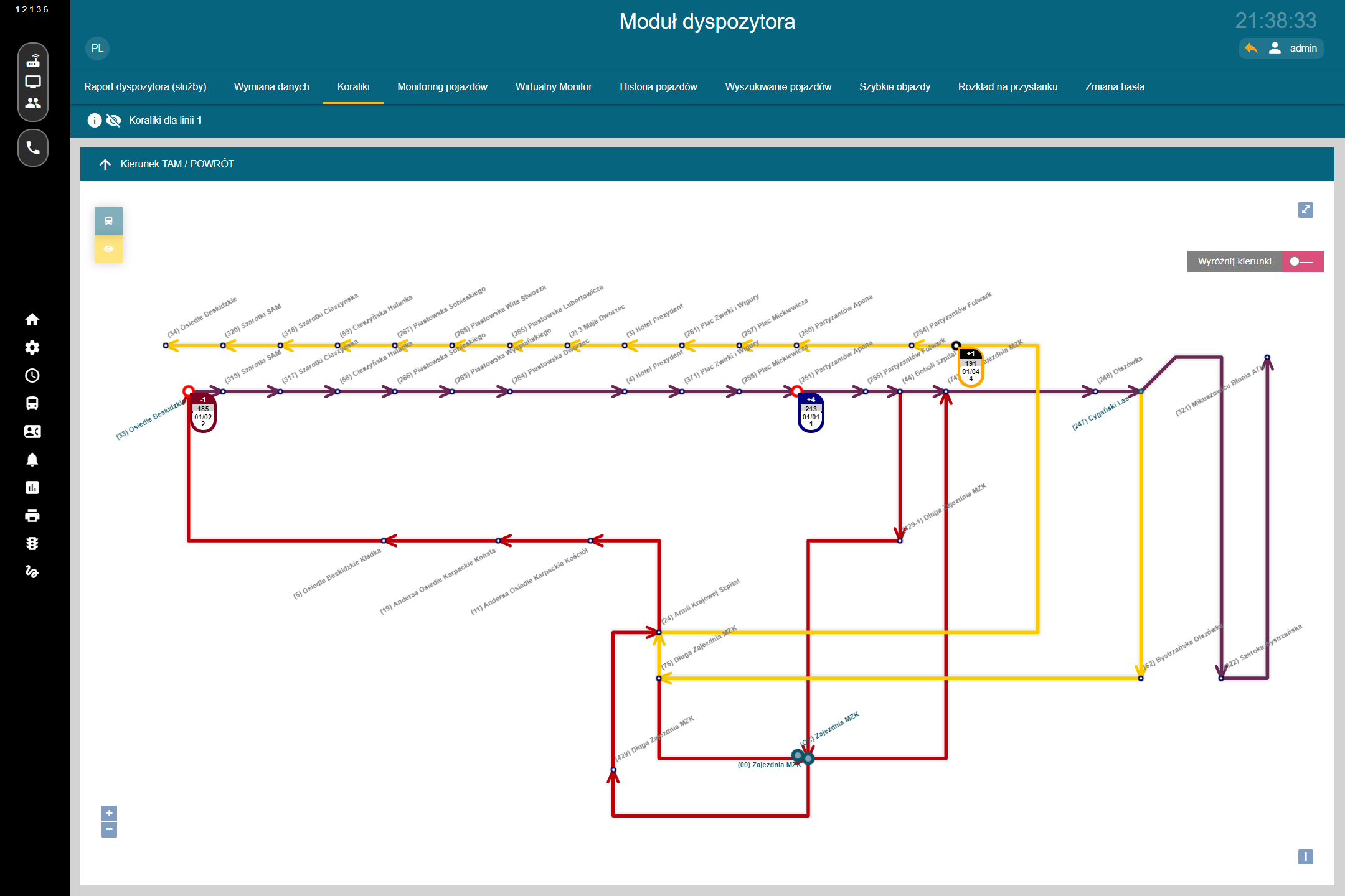
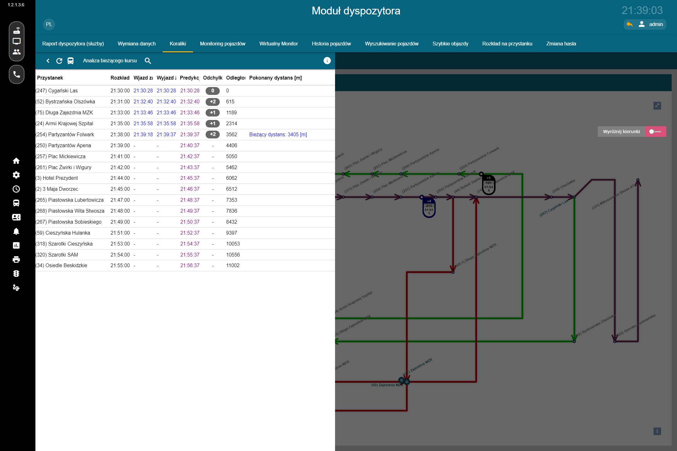
One of the tools available to dispatchers is a graphical line diagram showing vehicles operating on individual route variants together with their current deviation from the timetable.
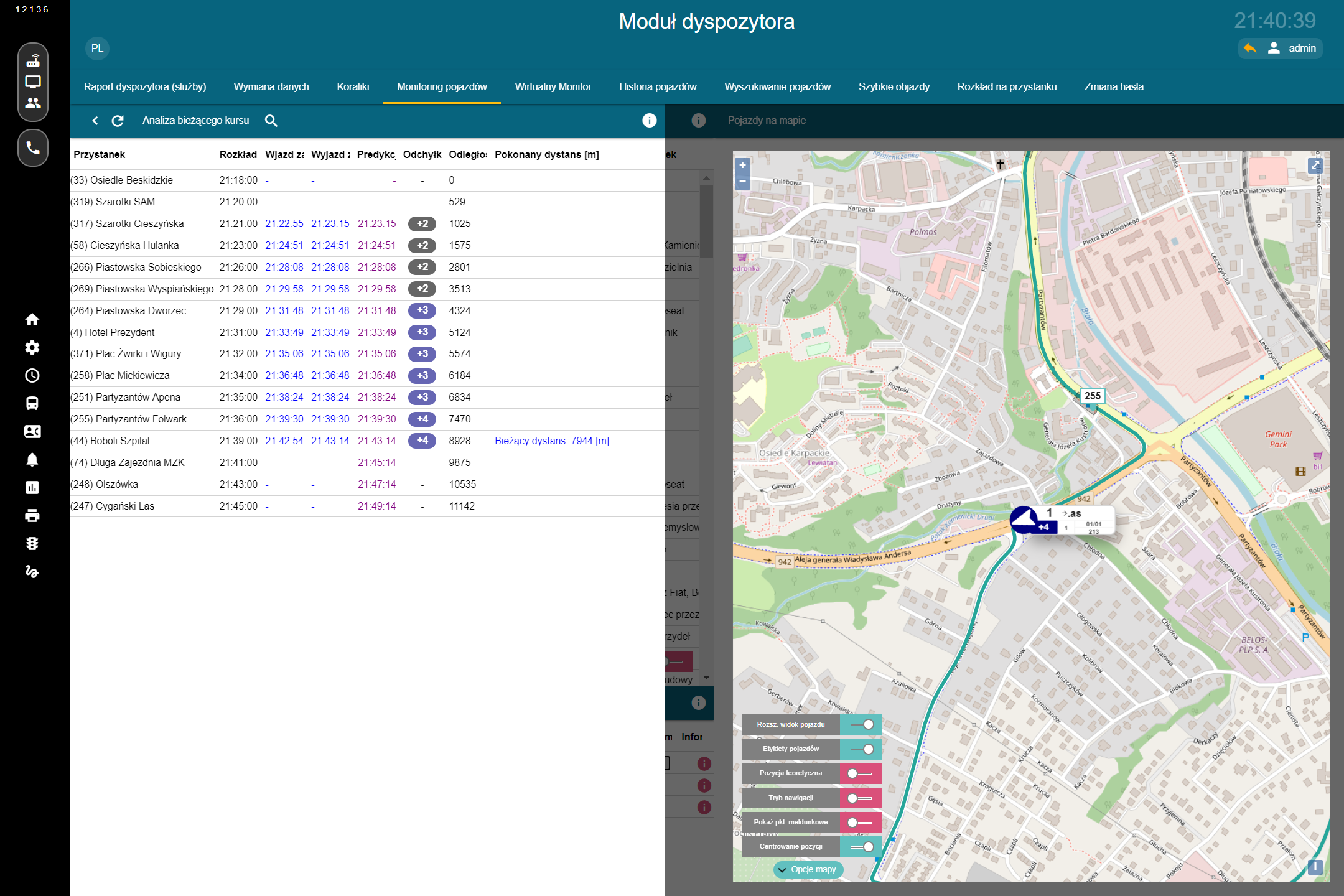
A single diagram can display multiple route variants, including vehicles entering and leaving service. Highlighting a vehicle emphasizes the route it is currently operating, while selecting it provides access to detailed information about the service, its current timetable deviation, and the forecast for the remainder of the journey.


Vehicle Search by Area
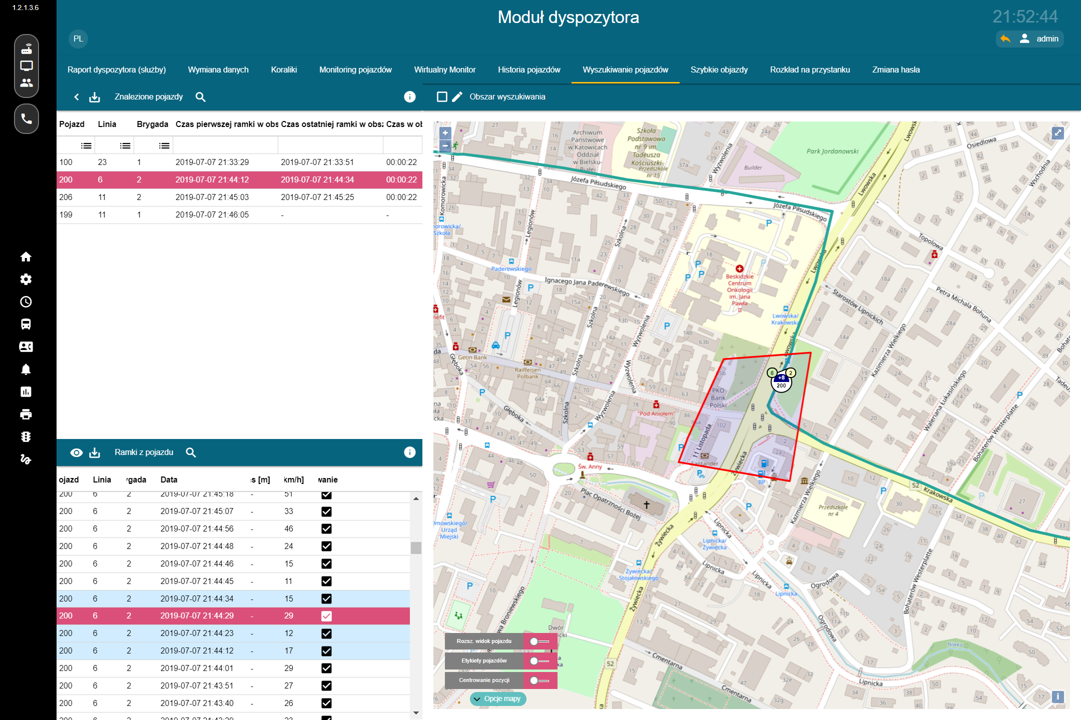
CeSIP allows users to select any area on the map and determine which vehicles were actually present within that area during a specified time period.
The feature works independently of scheduled services or punctuality levels and makes it possible to establish the actual presence of vehicles at a given location. It can be used for operational analysis as well as to support the needs of public safety and law enforcement services.
Rapid Detours and Incident Response
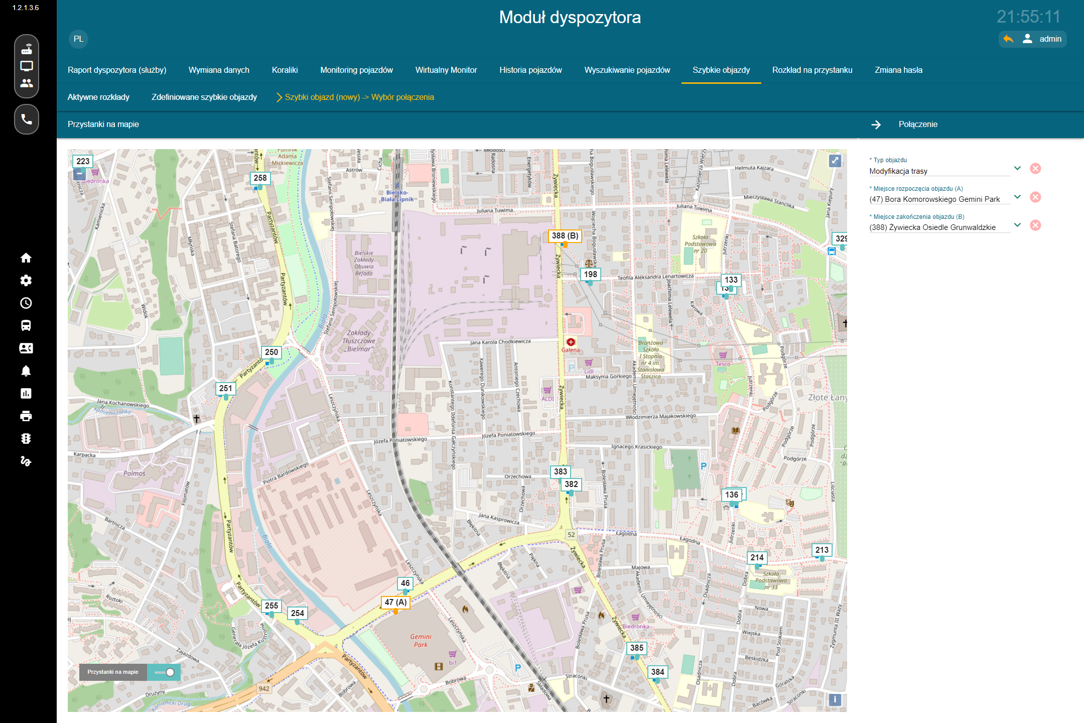
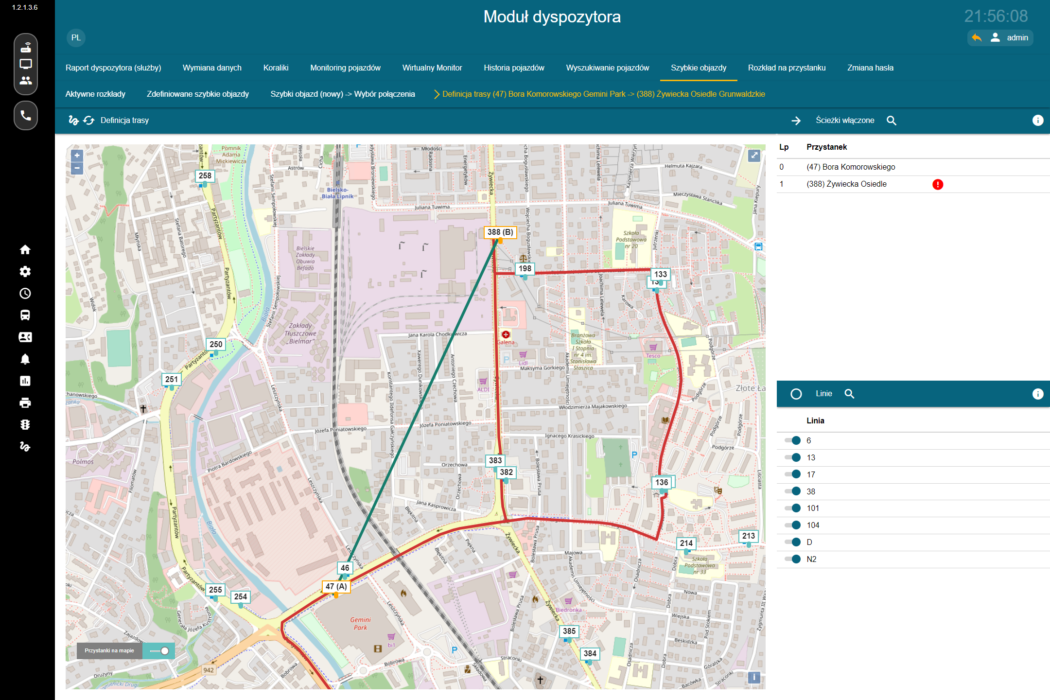
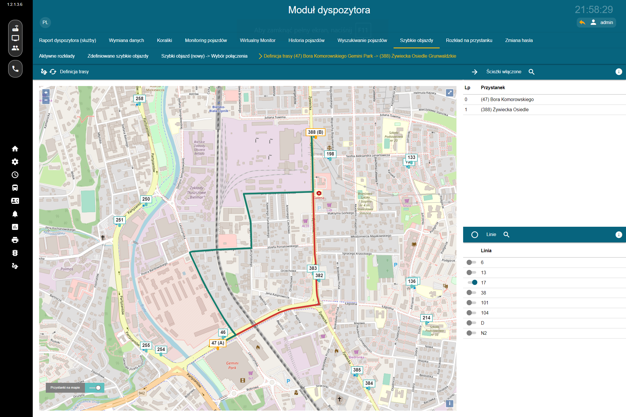
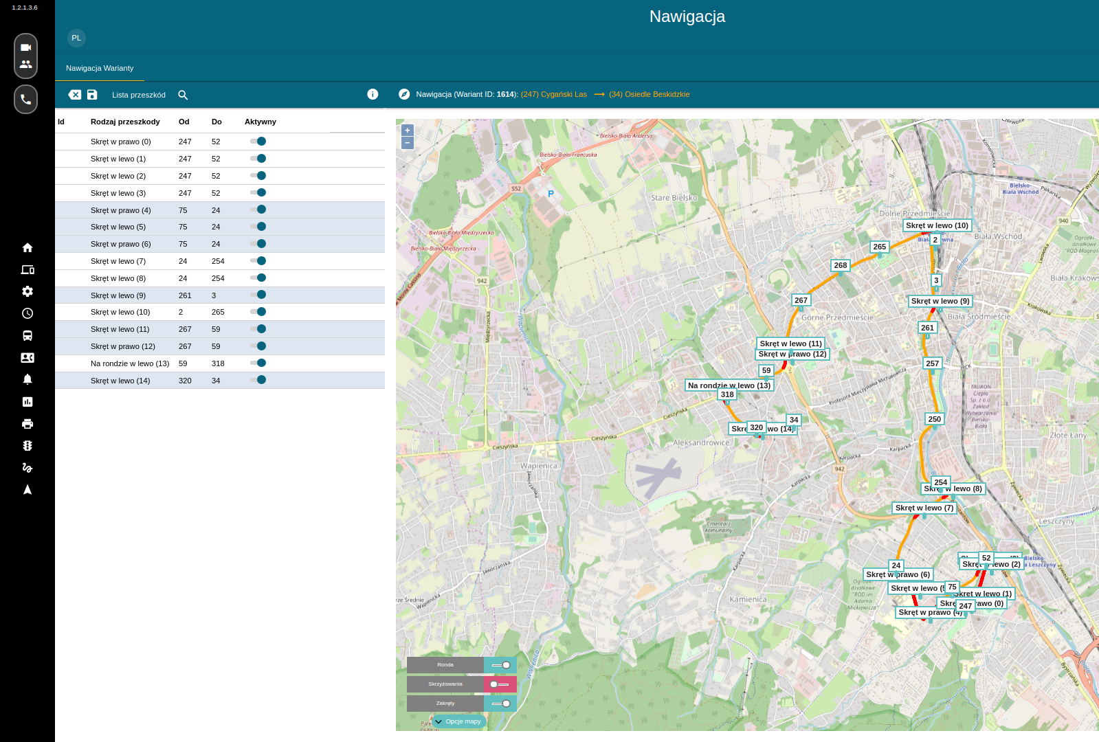
In the event of an accident, infrastructure failure, or another incident requiring a temporary change to traffic organization, a dispatcher can use CeSIP to quickly define a temporary detour.
The system allows the dispatcher to specify the start and end points of the detour, identify active timetables using the affected section, select the lines covered by the change, and define a new route.
Once approved, the change can be automatically distributed to the other components of the ecosystem, including vehicles, passenger information systems, and web services.
A Single Platform for Transport Management
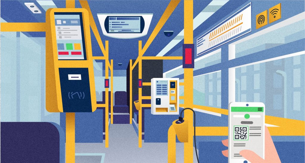
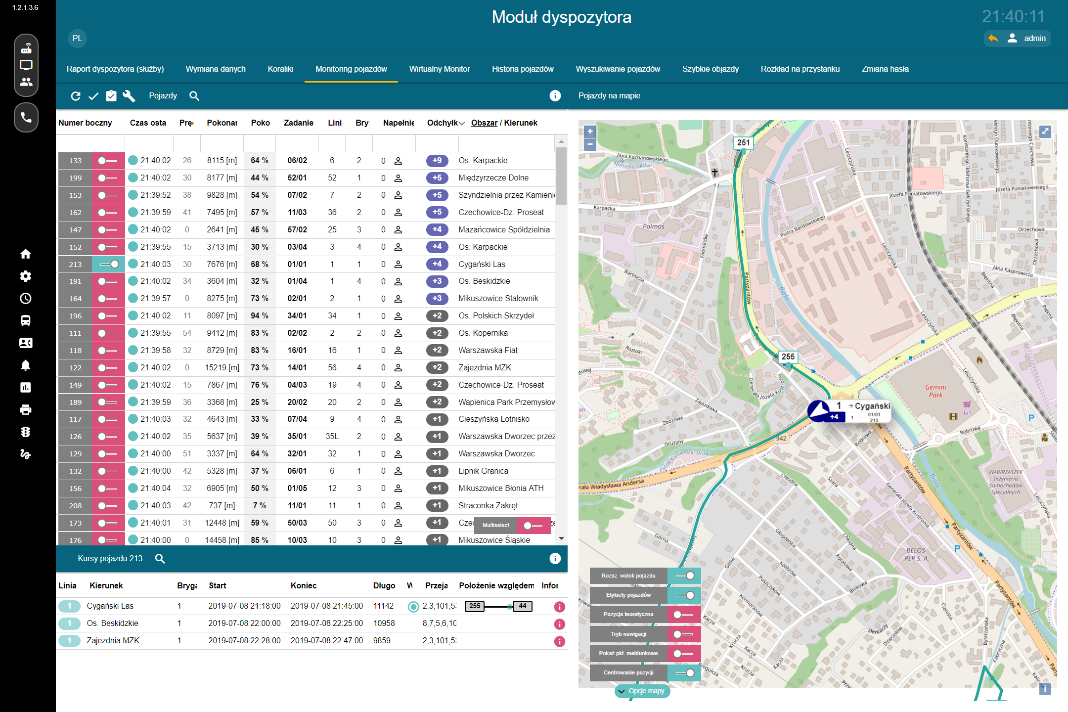
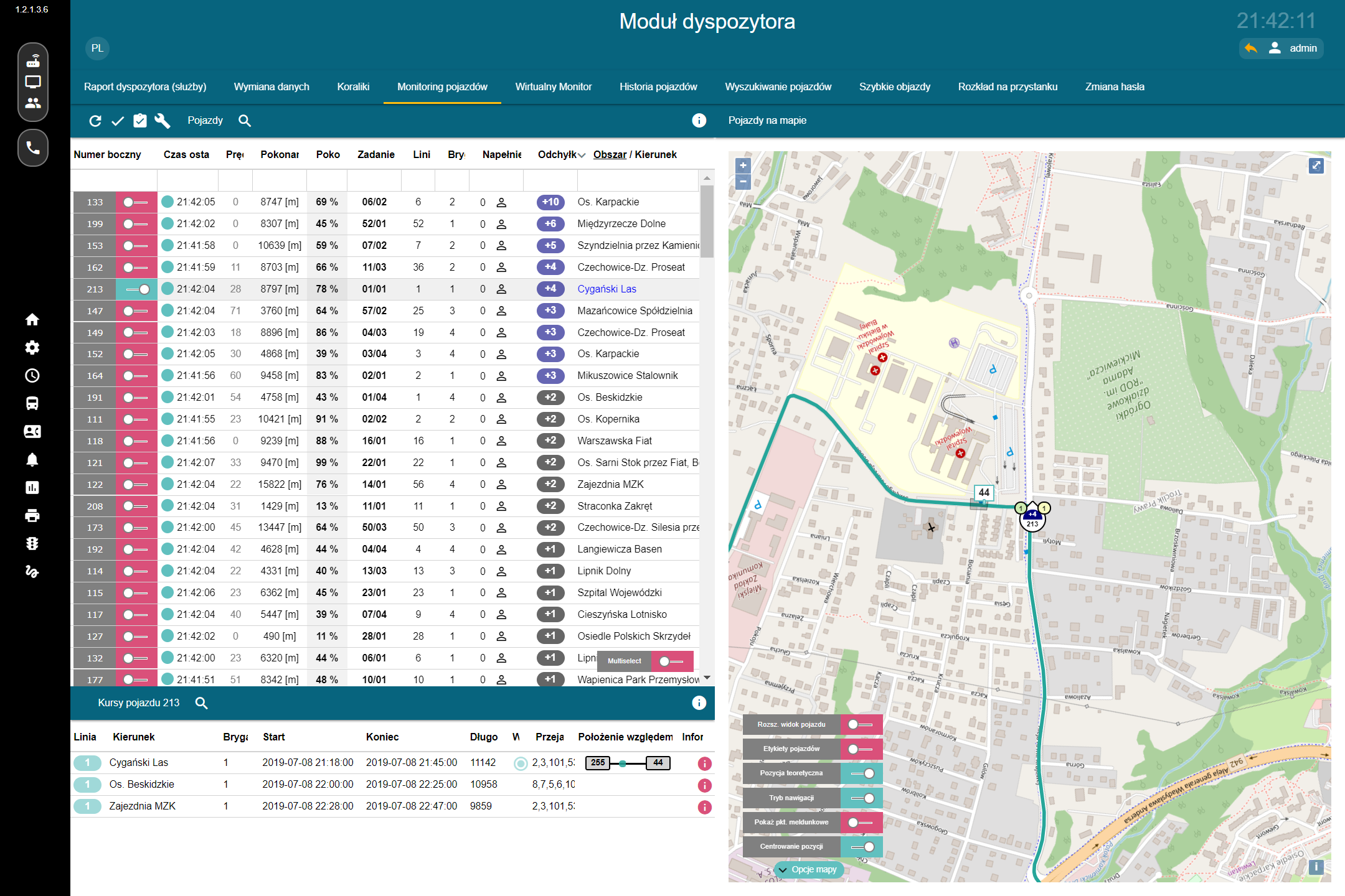
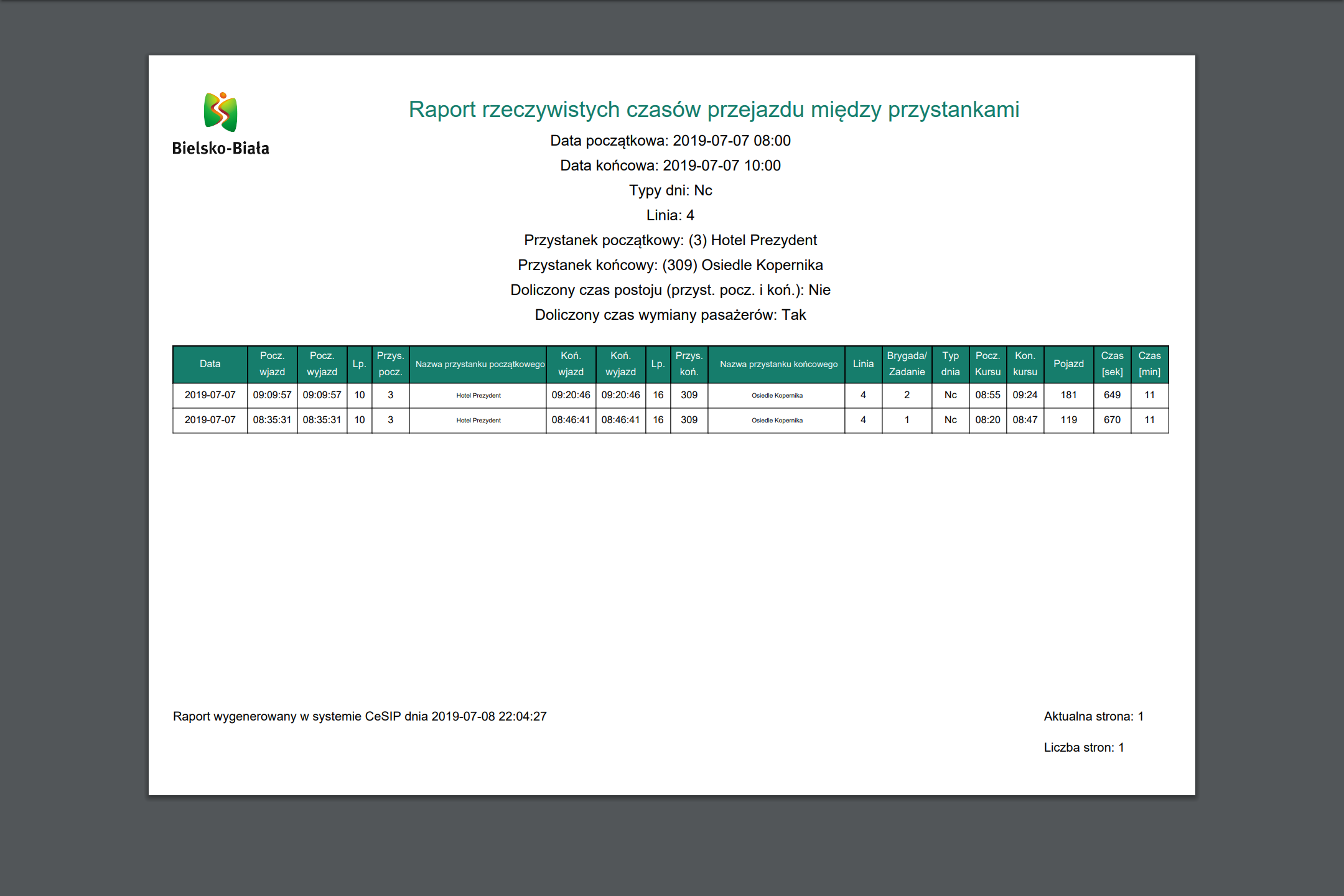
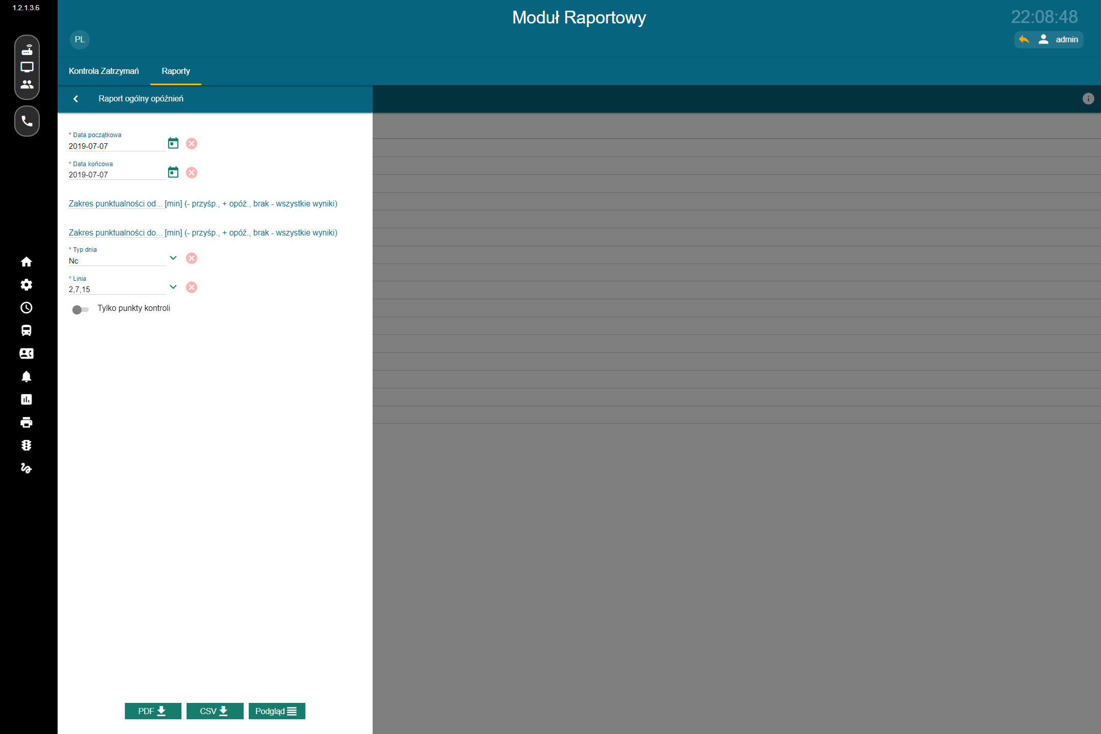
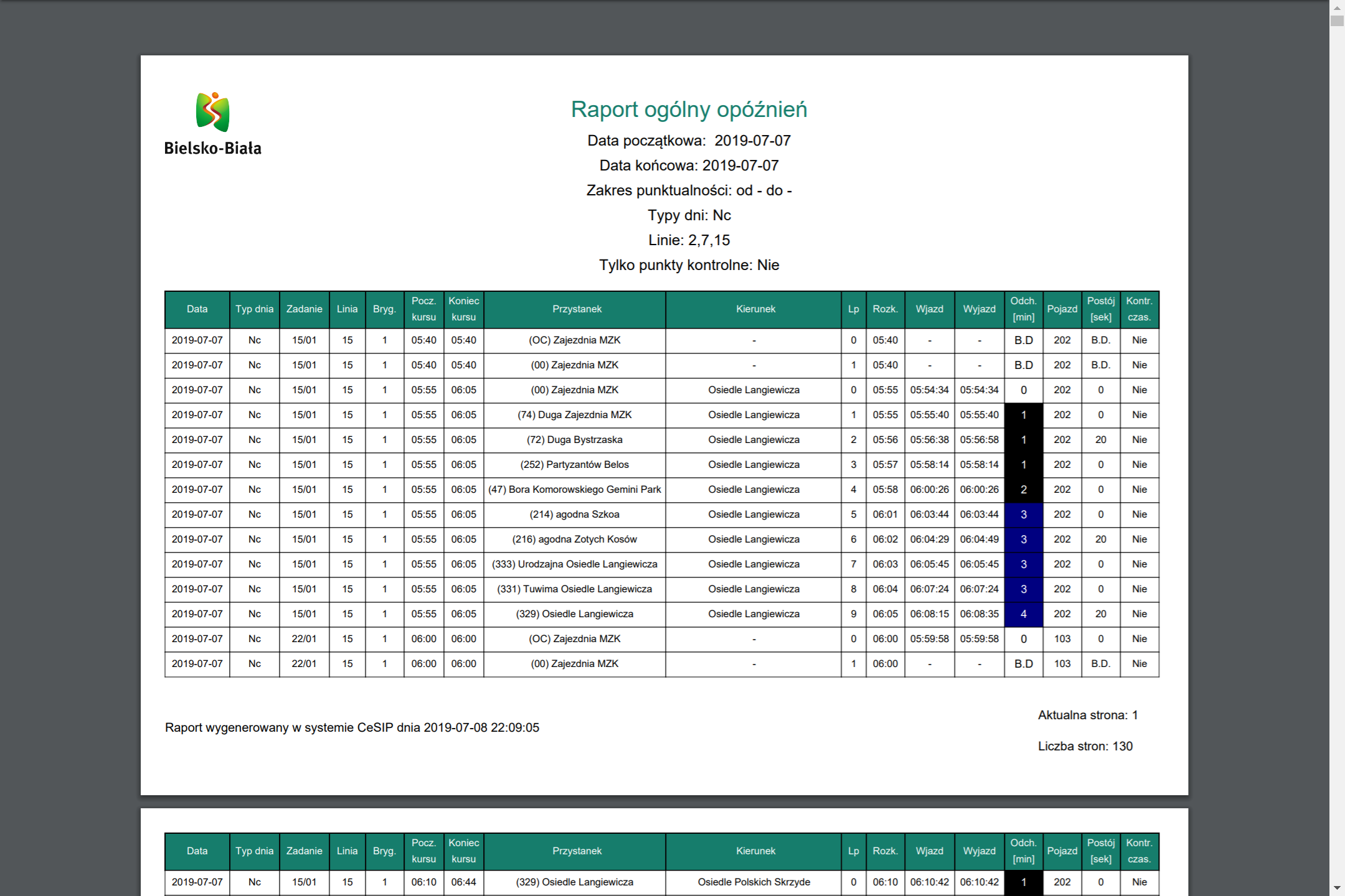
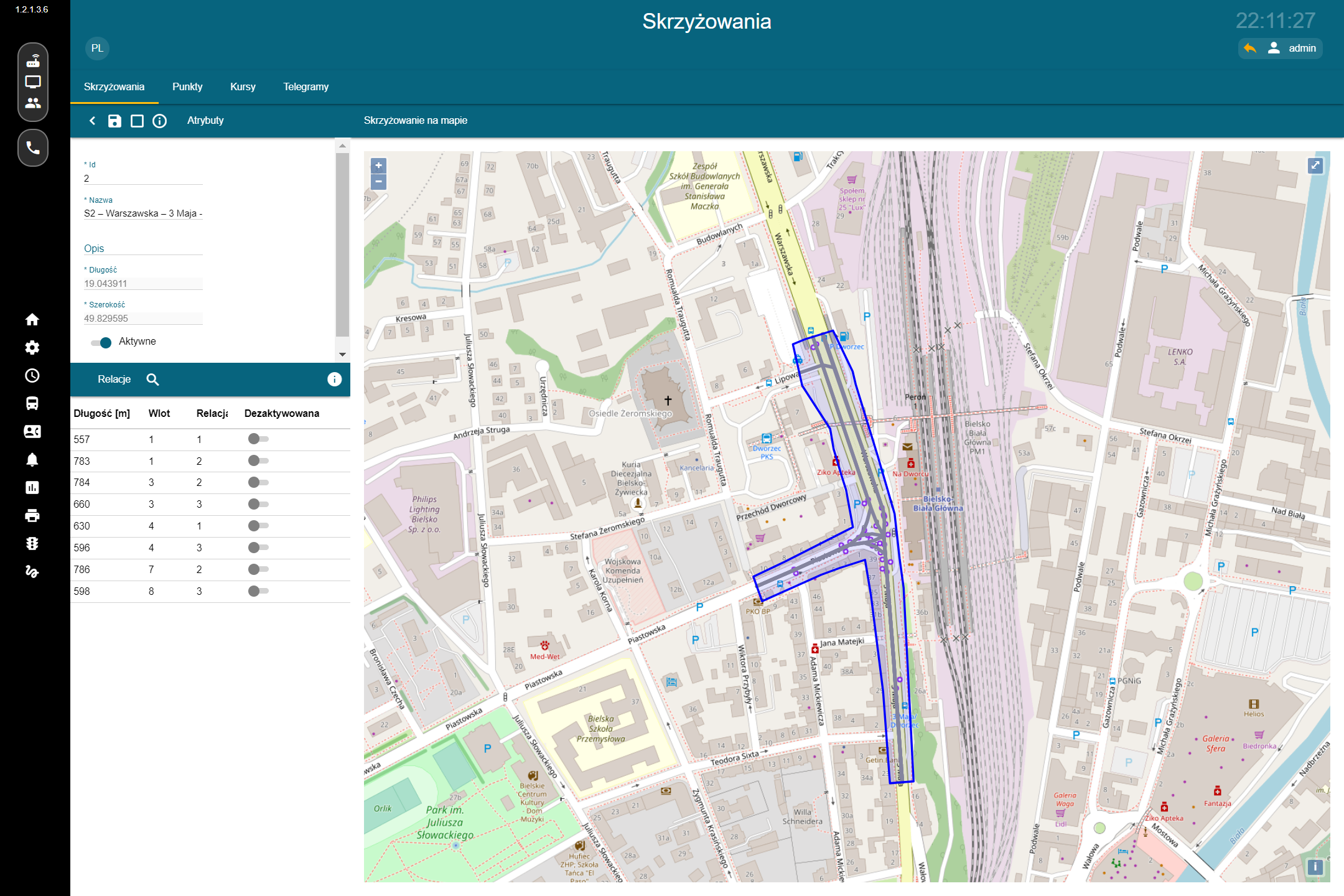
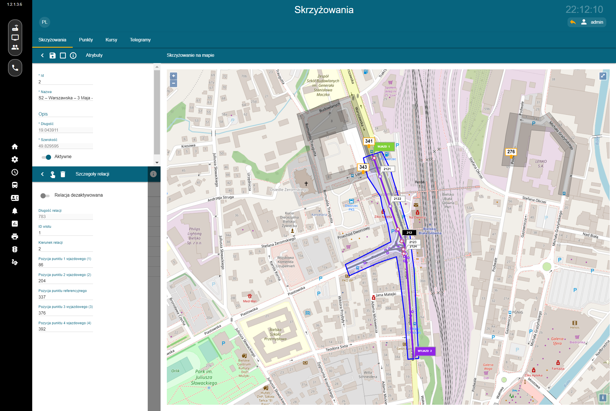
CeSIP brings together fleet management, timetable performance monitoring, dynamic passenger information, detour management, journey history, reporting, driver navigation, and public transport priority mechanisms within a single environment.
By integrating data from vehicles, timetables, and urban infrastructure, the system enables not only real-time monitoring of transport operations, but also rapid response to disruptions and in-depth analysis of service quality.
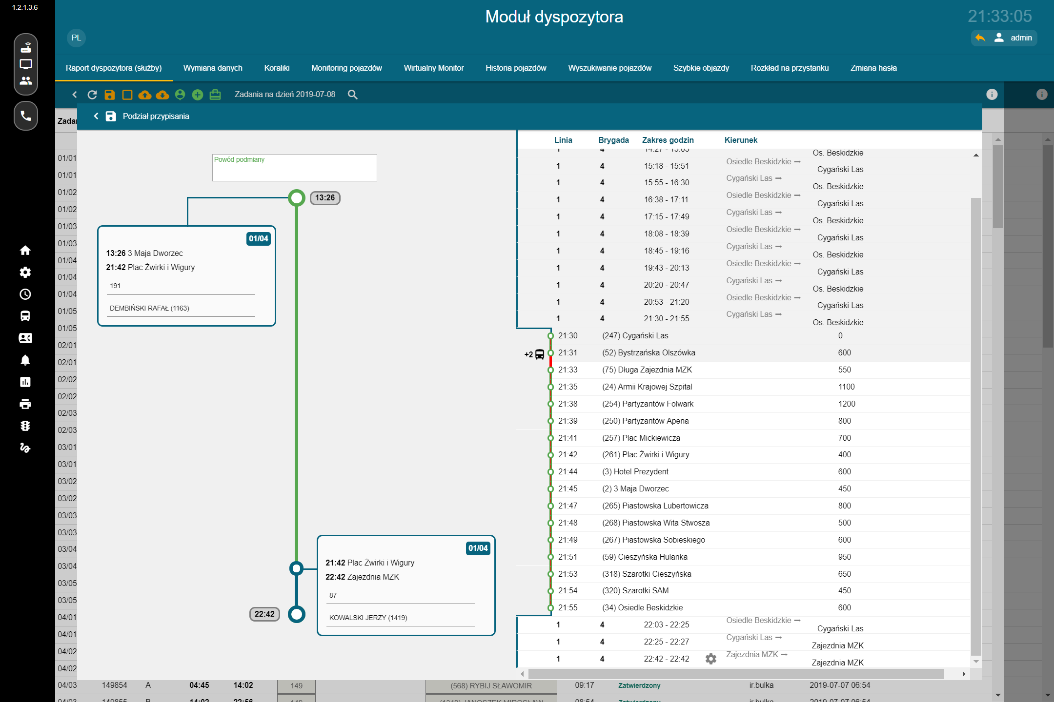
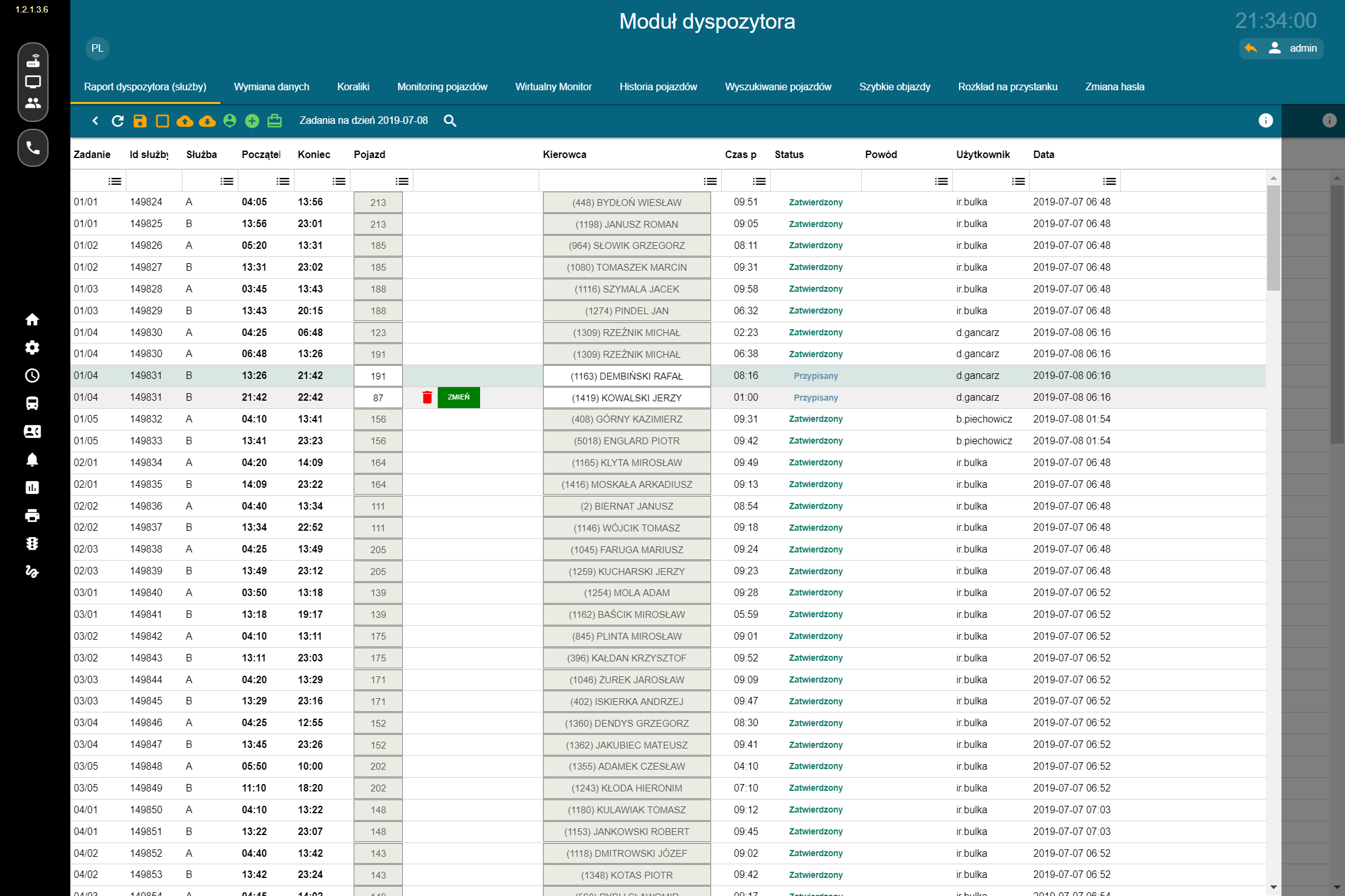
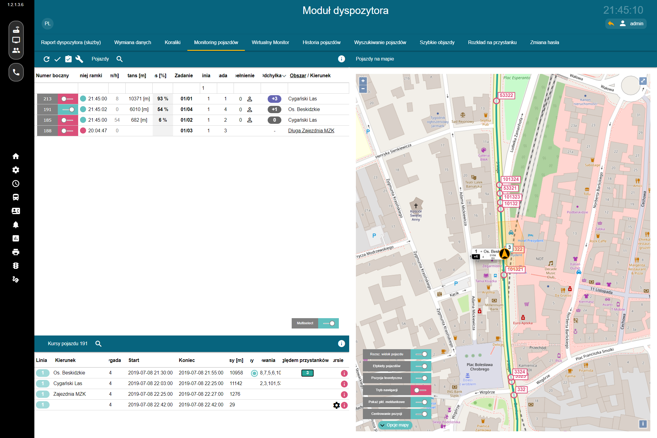
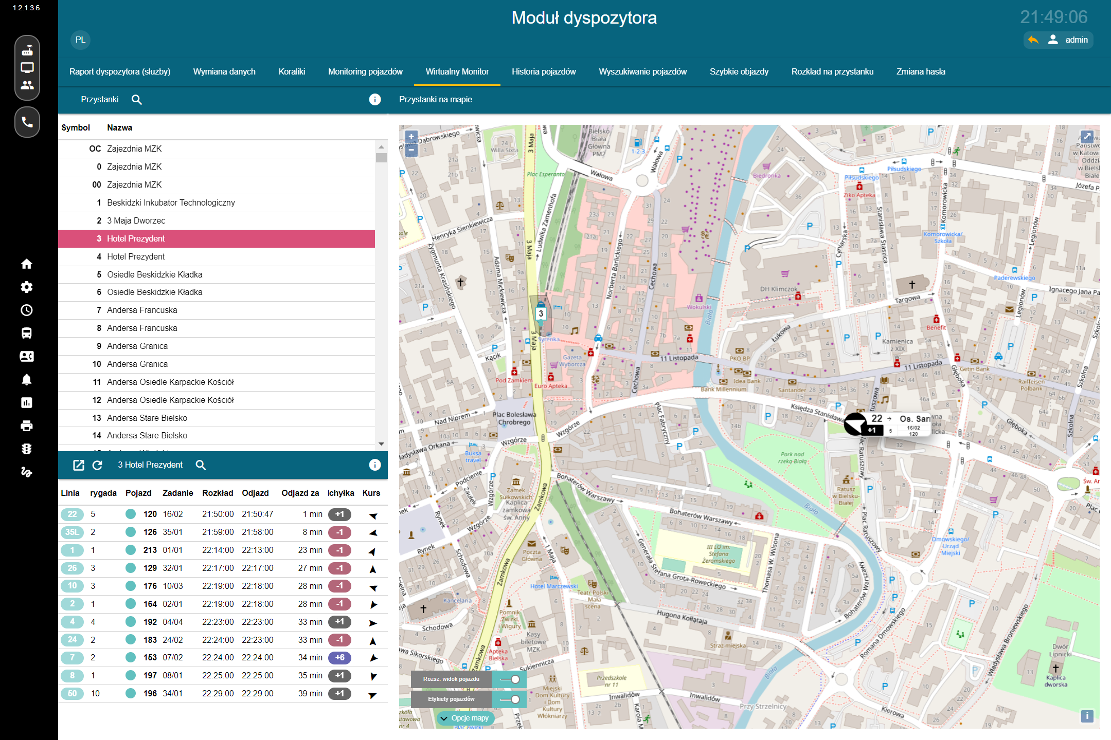
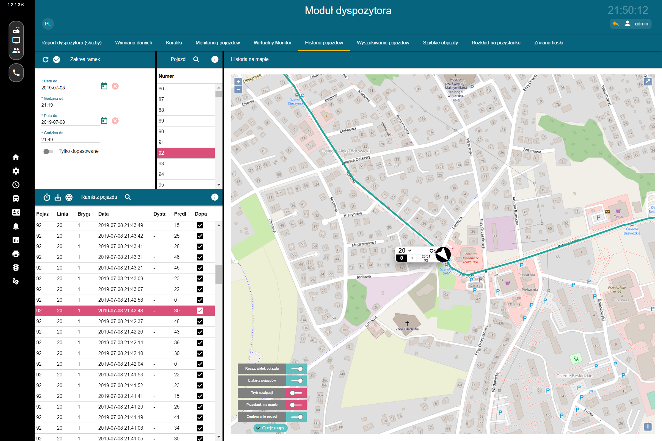
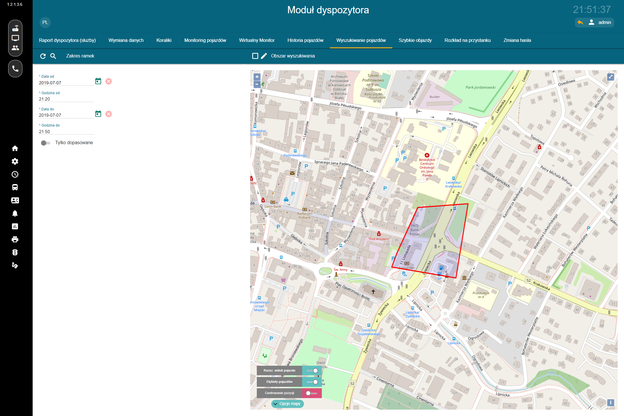
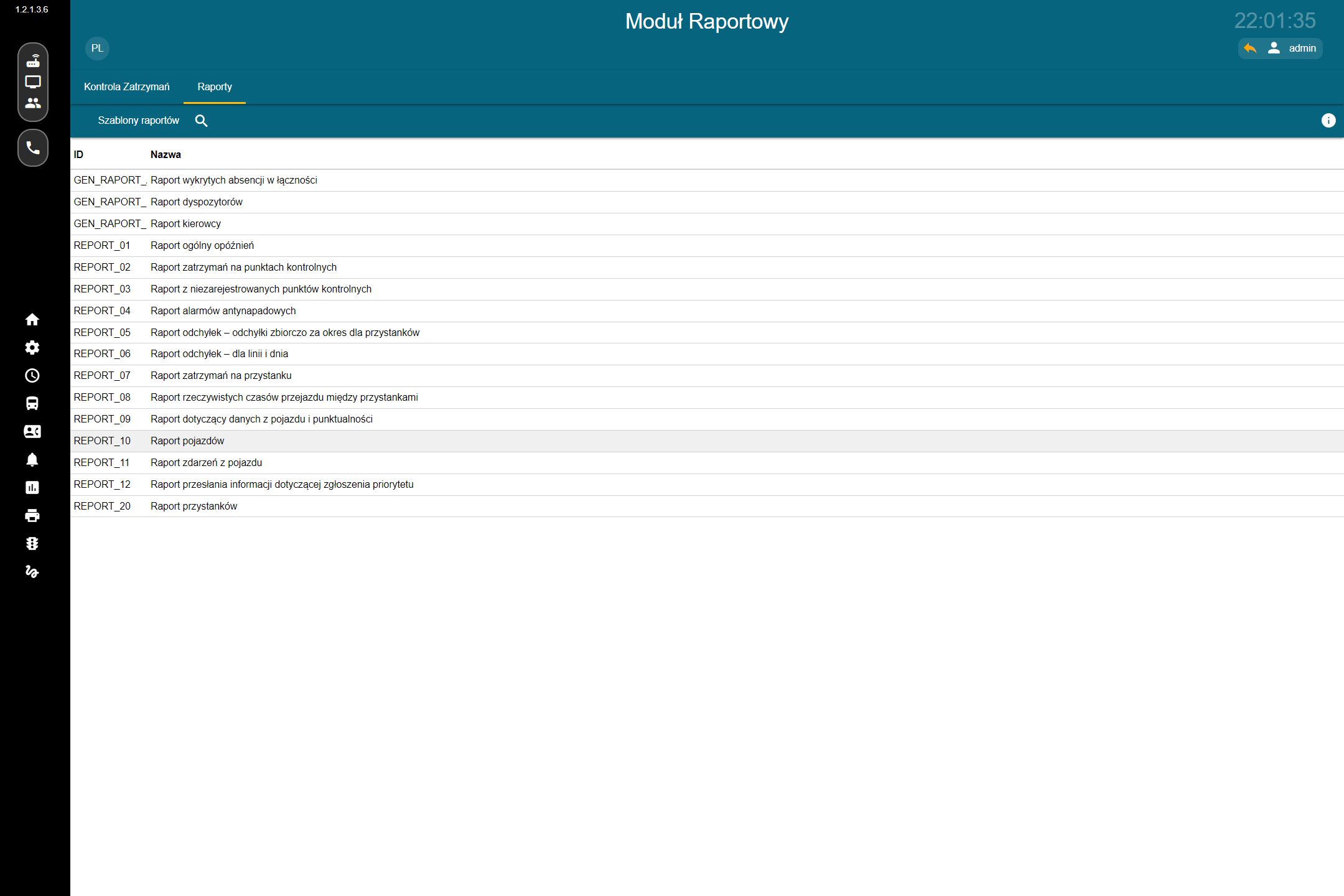
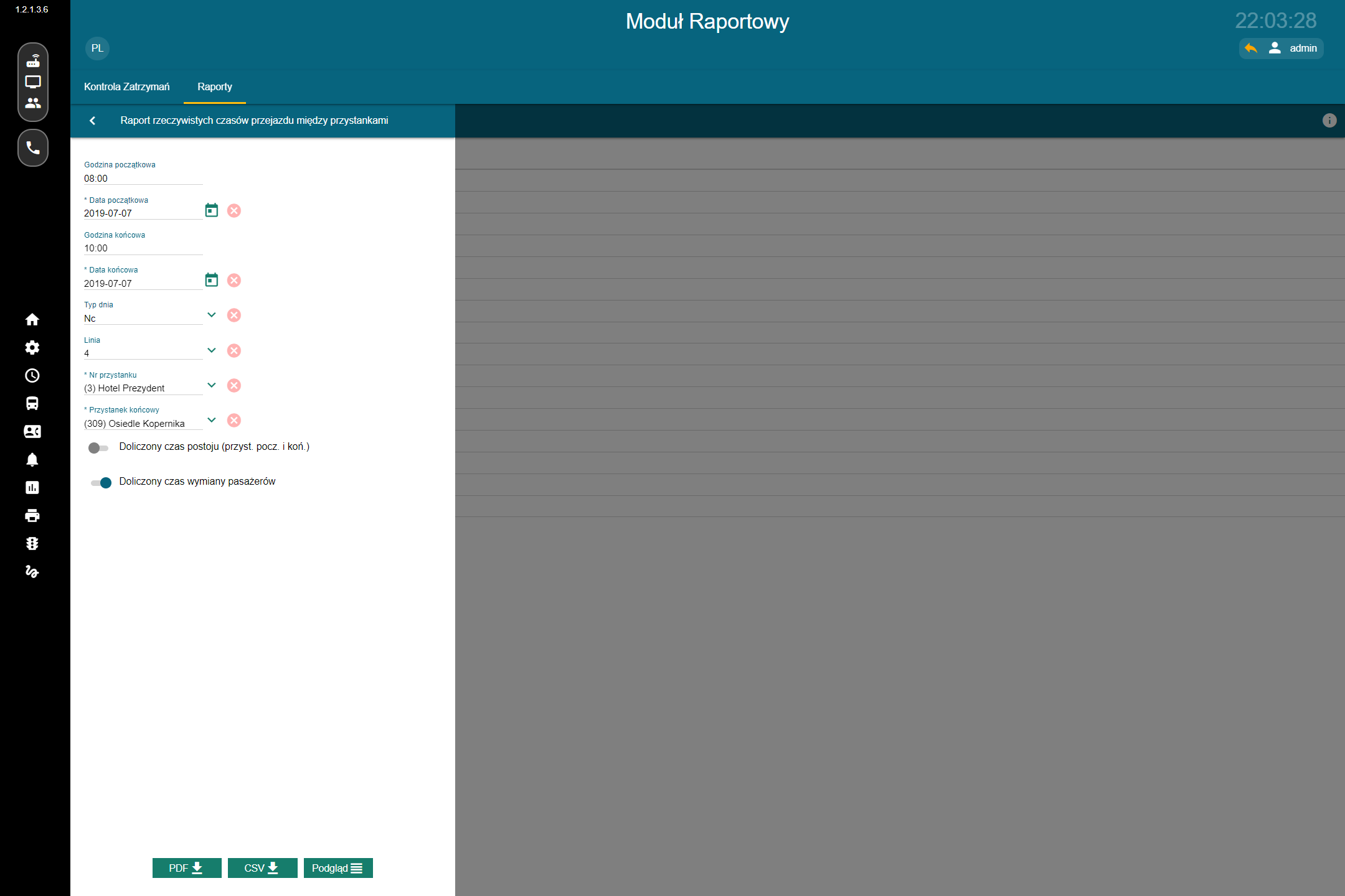
The system supports, among other things:
- improving service punctuality and regularity,
- providing dynamic passenger information at stops, online, and through mobile applications,
- supporting public transport priority,
- positioning stops and other points within the transport network,
- determining actual travel times and distances,
- supporting dispatchers and enabling information exchange between the control centre and vehicles,
- ongoing management of delays and early running,
- vehicle tracking on the map and real-time fleet supervision,
- analysis of deviations from the timetable,
- generating statistics comparing scheduled and actual times,
- centralized passenger information management,
- effective use of data from multiple subsystems,
- improving passenger service quality and increasing the attractiveness of public transport.
Additional Materials
Related Articles
See all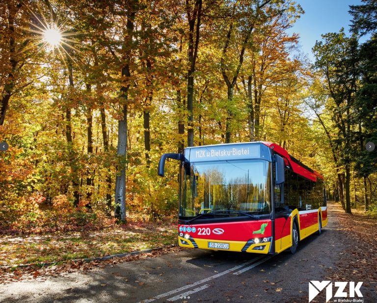
17/08/2026
Beesset as part of MZK Bielsko-Biała’s digital transformation
Bielsko-Biała is one of the cities where, over the past few years, we have had the opportunity to participate in a number of projects related to the digital transformation of public transport. Working under various cooperation models and subcontracting arrangements, we have delivered solutions including passenger information systems, such as the www.rozklady.bielsko.pl portal, components of […]
More information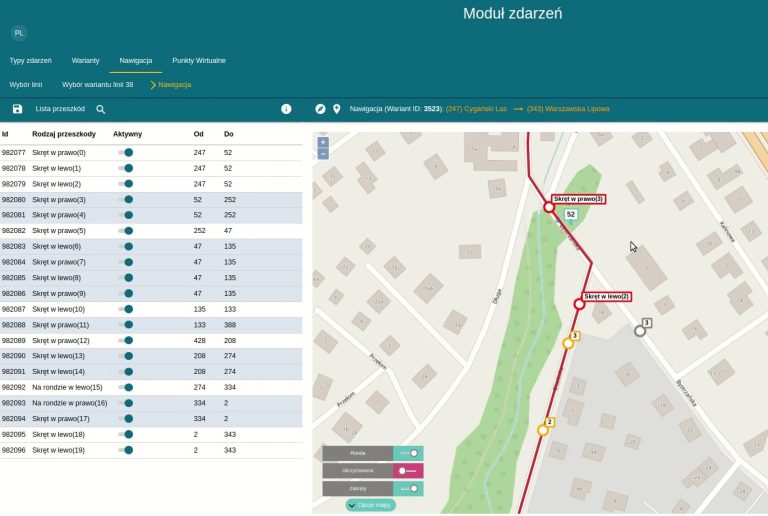
19/01/2022
Software for Rapid Detour Management
One of the tools we develop as part of ITS projects is back-office software for automatically preparing specialised GPS navigation for bus and tram drivers, displayed on onboard computer screens.
More information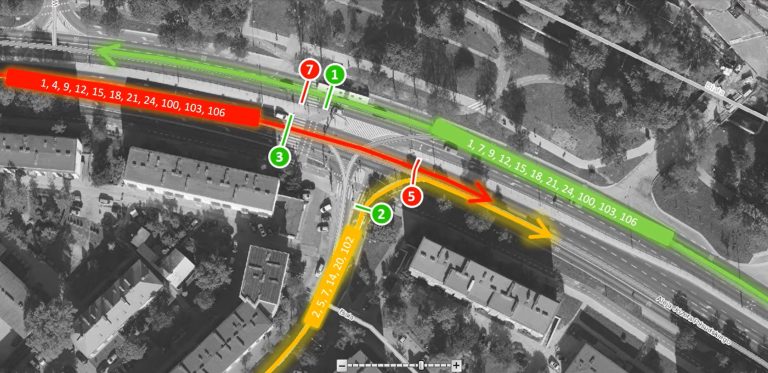
13/09/2021
Centralised Public Transport Priority System – the Białystok Example
In addition to dynamic passenger information systems and electronic ticketing, at Beesset we also develop ITS solutions related to public transport priority systems.
More information